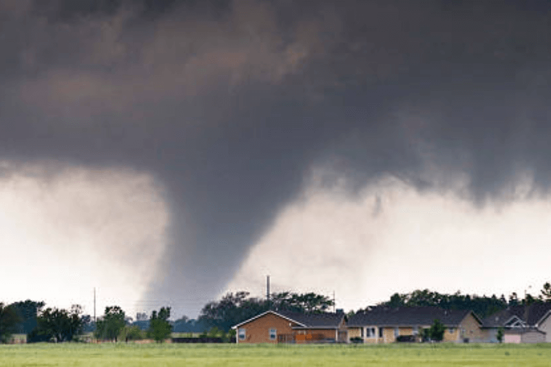
Tornado Risk Today: States Facing Severe Storm Threats on March 7, 2026
Tornadoes form when warm, moist air meets cold fronts, creating rotating supercells. Today, a low-pressure system over Missouri pushes this setup across the central U.S. This fuels storms from Texas to the Great Lakes. The Storm Prediction Center (SPC) emphasizes peak dangers now, affecting over 63 million people.
High-Risk States and Timing
Western Arkansas faces the highest threat late today into early tomorrow. Tornado watches are likely for damaging winds over 75 mph, large hail over 2 inches, and isolated tornadoes. Northeast Texas, including Dallas-Fort Worth, southeast Oklahoma, and the I-30 corridor have a slight risk (Level 2/5) from isolated supercells by mid-afternoon. Further north, the Ohio Valley to western New York and Pennsylvania will see afternoon storms along a warm front. These storms may cause wind damage and a few supercells.
Why Today Stands Out
This multi-day outbreak reached its highest point on Friday but continues into Saturday with a 5% chance of tornadoes nationwide. Nighttime increases the risks because reduced visibility makes it harder to issue warnings. Increased shear and instability raise the chances of supercells, in contrast to linear storms in other areas.
Safety Essentials
Seek shelter in interior rooms away from windows. Monitor NOAA Weather Radio or apps. Avoid flooded roads, as flash floods can happen with hail. Power outages from winds could last for hours; prepare kits with water and flashlights.
FAQs
1. Which states have the top tornado risk today?
Western Arkansas leads, with NE Texas, SE Oklahoma, and OH Valley next. SPC Slight Risk covers these for supercells.
2. What time do storms peak on March 7?
Mid-afternoon to evening in AR/TX/OK; afternoon in OH Valley. Night risks rise into early March 8.
3. How can I stay prepared?
Download weather apps, have a safe room plan, and heed sirens. Avoid travel if watches are an issue.
Summary:
On March 7, 2026, severe thunderstorms threatened western Arkansas with tornado watches, plus risks in NE Texas, SE Oklahoma, and OH Valley. Expect winds, hail; NWS flags multi-day event peaking now.