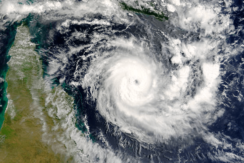
National Hurricane Center 2026 Update: Why the Forecast Cone Is Changing
Current hurricane forecast information is from the National Hurricane Center, which is also being updated with new data for 2026, as there has been ongoing improvement in the accuracy of storm track forecasts and thus the size of the cone has decreased slightly compared to 2025 as a result. The size of the cone in the Atlantic Region will be approximately 4%-8% smaller than existing estimates based on improved accuracy of forecast over each of the past five years as well. This is meant to provide a better representation of the probable path of storms rather than imply that storms are any less hazardous.
What the new cone shows
One of the most noticeable changes is that the cone graphic includes tropical-storm and hurricane watches and warnings for inland locations; previously, this was limited to coastlines only. It is important that these inland areas be aware of potential damaging winds and flooding due to landfalling storms, as they can occur a considerable distance away from the coast. The new map will help those people in inland counties better understand the potential risk they face during these storms that affect their communities.
Why it matters to people
Many people think the cone indicates where the worst impacts will occur, but it actually shows where the storm center is likely to go. Even if the center is outside the cone, strong winds, heavy rain, and surge can still affect areas far beyond it. The new design aims to reduce confusion and make the message clearer so the public can respond quickly.
Simple way to read it
Think of the cone as a probability map rather than a damage map. A smaller cone indicates that forecasts are improving, but it does not mean the storm is weaker or safer. For readers, the key point is to pay attention to local alerts, not just the centerline.
FAQs
1. Why is the cone getting smaller?
Because NHC forecast errors have decreased, the likely track can be shown more tightly.
2. Does a smaller cone mean less danger?
No. It only means the forecast is more precise, while impacts can still extend far outside the cone.
3. Why add inland alerts to the map?
To help people away from the coast see that hurricanes can still bring dangerous winds and flooding inland..
Summary:
The NHC’s 2026 forecast cone is changing because forecasts have improved, so the error range is smaller, and the map now highlights inland wind hazards too.